Flatwater

FULL Minesing Wetlands Adventure: Willow Creek Launch to Edenvale

EVENT SIGNUP IS FULL; please contact organizer (Tom Connell) re wait-list or confirmation. This one-day 18km trip will take us down the Willow Creek into the heart of the Minesing Wetlands (designated internationally significant), through an often flooded silver maple forest, and onto the Nottawasaga River, ending up at Edenvale Conservation Area. Scenery is highly dependent on water levels, which can very greatly depending on the time of travel and spring runoff. You may need to get out and pull your boat at some places in the heart of the wetland.

The Basics
Event Location: 
George Johnston Rd, Minesing, ON L0L 1Y0, Canada 44.422132, -79.823497
Date(s) & Time: 
Saturday, May 6, 2023 - 09:00
Registration Cut Off: 
Friday, May 5th, 2023
Event Duration: 
One Day
Difficulty Rating: 
Beginner
Participant Info
Who's Invited: 
WCA members, etc.
Maximum Group Size: 
Currently at limit
Minimum Group Size: 
2 boats
Itinerary
Itinerary description: 

Gather at Willow Creek Boat launch, and unload boats and gear. At 9:30am, shuttle cars to Edenvale Conservation area. Parking fees at the boat launch can be paid using a mobile phone app (MacKay Pay). Aiming to be on the water by 10am.

Required Items to Bring: 

-- Standard safety gear for your canoe
-- Appropriate footwear for getting out in shallow spots or pulling over logs
-- Lunch / drinks / snacks for trip
-- Seasonally appropriate clothing, to deal with wind/rain/cold/wet.
-- Be prepared to improvise for bathroom needs; firm ground is sporadic

Recommended Items to Bring: 

-- Sunscreen / bug spray
-- GPS / compass
-- Masks for car shuttle

How to Get There
Event Directions: 

2302 George Johnston Rd (Simcoe County Road 28), about 2km south of community of Minesing, ON L0L 1Y0, Canada
44.422132, -79.823497

Carpool Info: 

Car shuttle will take vehicles to Edenvale Conservation Area on Highway 26 (44.453896, -79.902065).

Other
Cancellation Policy: 
Event will occur rain or shine; reassess day before if weather is awful
Event Coordinator/s Contact Information
Contact (Name): 
Tom Connell
Phone: 
00000

The Rideau Canal - Kingston to Ottawa! Or parts thereof.

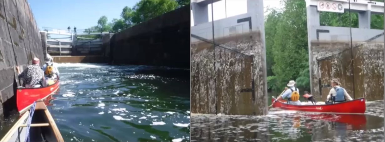
"From May to October, the canal is open as a 202 km-long navigational waterway for boaters and paddlers. This historic lockage system and UNESCO World Heritage Site, consists of 29 individual locks, and facilitates travel up and down the canal through many remote environments and townsites." I have paddled the entire length of the canal 1.5 times. This May I am organizing a paddle for WCA members. There is an article in the Nastawgan ('Tripping Ontario's Two Great Canals') that was published in the Fall of 2022, on my adventures on the Rideau, and the Trent Severn Canal. (https://www.youtube.com/watch?v=04PjIiLpqdA) This is a sort of 'glamping' trip, ideally suited for flatwater paddlers who might wish to try a long trip for the first time, without the stress of back country camping. All nights on this trip will be either at the Rideau canal's locks on nicely mown grass, or in a proper campsite such as exists at a Provincial Park.

The Basics
Event Location: 
The Rideau Canal, Ontario
Date(s) & Time: 
Saturday, May 27, 2023 (All day)
Registration Cut Off: 
May 20,2023
Event Duration: 
10 days (see Itinerary)
Difficulty Rating: 
Beginner
Participant Info
Who's Invited: 
All WCA members and their friends
Maximum Group Size: 
8 boats/canoes
Minimum Group Size: 
1 boat
Itinerary
Itinerary description: 

We will paddle from Kingston, all the way to Ottawa, ending at the last locks which sit just above the Ottawa River. More than likely we will do a short portage with canoes up to do a photo opportunity with the Parliament Buildings in the background.
While we will plan to cook our own food along the way, and share in a lot of the meal preparation, but we will also take the opportunity to sample some of the food at restaurant/pubs that are accessible along the way.
As the occasion approaches we will work out a 'functional' itinerary. TBD
** It is possible to ride every lock just like the power boats. But that adds an extra cost (they charge by the foot, and its best to buy a pass. Personally, I skip this as I need to get out and stretch ... so I portage most of the locks. Occasionally the lock masters/people who work the locks just let you through for free.

Required Items to Bring: 

All your own canoeing and camping gear. Be prepared for cool nights and the occasional rain storms. As this is a flatwater trip there is NO need to bring a heavy whitewater canoe. If you are portaging all the locks a Kevlar boat is best.

Recommended Items to Bring: 

Bring cash/debit card for camping costs ... its $5/night/person at the locks. The few nights at the provincial parks will be more. I will give more details as the time approaches. I will have maps available for people that I can copy if anyone wants their own. Cell coverage is pretty decent ... google maps works most of the time. Bring a charger ... there are outdoor plugs at a lot of the Lock stations.

How to Get There
Event Directions: 

TBD

Carpool Info: 

TBD

Other
Cancellation Policy: 
Just let me know, please, a reasonable amount of time before the trip.
Event Coordinator/s Contact Information
Contact (Name): 
iori miller
Phone: 
contact me via my email

Lower Don River - Past, Present and Future

This will be a journey through time, as we assess the current state of the Don River, look at signs of its past, and get a sense of what the future holds. Sponsored by the WCA Conservation Committee, this outing will put-in at Corktown Commons and proceed north up the river to the area of the Prince Edward Viaduct (a distance of just under 3km). Shallows and minor current towards the north end of the route will influence how far up-river we proceed. We will then return to Corktown, and take a look south towards Keating Channel to see what's going on with the Portlands renaturalization and flood protection project.

The Basics
Event Location: 
Corktown Commons, Toronto
Date(s) & Time: 
Sunday, October 23, 2022 - 08:30
Registration Cut Off: 
10/18/2022
Event Duration: 
Approximately 3 hours
Difficulty Rating: 
Novice
Participant Info
Who's Invited: 
Anyone interested
Maximum Group Size: 
5 boats
Minimum Group Size: 
2 boats
Itinerary
Itinerary description: 

Meet at 8:30am at Corktown Commons at corner of Mill Street and Bayview Ave (southern point of Bayview). Various on-street parking options are available. Portage canoes under rail line, approximately 300m to put-in location off Lower Don Trail. Head-off to north by 9am. Aiming to be back to Corktown Commons by noon (no car shuttle required!).

Required Items to Bring: 

Standard safety gear for each boat and seasonally-appropriate clothing.
Footwear appropriate for stepping out of canoes, depending on water levels up river.

Recommended Items to Bring: 

- snacks and water
- rain gear
- Don River lore

How to Get There
Event Directions: 

Meeting point is Bayview Avenue at Mill Street (43.652842N, 79.353135W)

Carpool Info: 

Participants can come to arrangements as event approaches.

Other
Cancellation Policy: 
Event will occur rain or shine; reassess day before if weather is awful
Event Coordinator/s Contact Information
Contact (Name): 
Tom Connell
Phone: 
xxx-xxxx

Trent-Severn Canal: Buckhorn to Lakefield

An easy paddle of a section of the Trent-Severn Canal, to give people a taste of this 'clamping' paddle-holiday adventure. If you haven't done any serious tripping/back country camping this is a wonderful opportunity to have a taste of it with some people who have quite a bit of experience. The camping on this trip is easy and comfortable ... and A LOT CHEAPER THAN GOING TO A PROVINCIAL PARK!????

The Basics
Event Location: 
Buckhorn to Lakefield
Date(s) & Time: 
Friday, September 9, 2022 (All day)
Registration Cut Off: 
Sept 7, 2022
Event Duration: 
2 nights, 2 days
Difficulty Rating: 
Novice
Participant Info
Who's Invited: 
WCA members and friends
Maximum Group Size: 
4 boats
Minimum Group Size: 
One (me!)
Itinerary
Itinerary description: 

I was planning a few days solo paddling on the canal and a friend suggested I open it as an opportunity for others to get a taste.
Presently I am planning to make it three days. I will begin Friday (Sept 9) from Bobcaygeon to Buckhorn (28km) and camp there. Saturday (Sept 10) I will paddle from Buckhorn to Lovesick Lake Lock (10 km) and camp there. Sunday (Sept 11) I will paddle from Lovesick Lake Lock to Lakefield (22 km).
Anyone wishing to join can either start with me at Bobcaygeon for the friday paddle, or just meet me at Buckhorn on the friday night and only paddle the saturday and sunday part of my trip.

Required Items to Bring: 

All your own normal tripping gear: tent, sleeping bag and pad, rain gear!!!!, canoes, paddles, PFDs, sunscreen, sunhat!!, etc.

Recommended Items to Bring: 

Camera, some cash, a sunny disposition.

How to Get There
Event Directions: 

Meet either at the Bobcaygeon lock or the Buckhorn lock according to when you want to join me.

Carpool Info: 

We will work this out once I know who is coming. I live in Lakefield ... just a 5 minute walk from the takeout so we will coordinate the carpool according to how many people come.

Other
Cancellation Policy: 
None. Just let me know asap!
Event Coordinator/s Contact Information
Contact (Name): 
iori miller
Phone: 
Please use email

Quetico -- Last of the Summer

Twelve days in the Park, catching the last of the summer. Water levels are relatively high, and the bugs are gone. There are fish. The portage crews have been through. The park had about 14 % burn last year, but there are currently no fires in the park. The plan is to seek the virgin forest in the park. From Baptism Creek to Baptism Lake to Cache, a rather long portage; if water levels are high, Cache River; if not, another long portage to McKenzie. Then over to Shan Walshe and back up through Kahshahpiwi/Chatterton and out through French.

The Basics
Event Location: 
Quetico
Date(s) & Time: 
Wednesday, August 31, 2022 - 07:30
Registration Cut Off: 
08/24/2022
Event Duration: 
12 nights in the park
Difficulty Rating: 
Intermediate
Participant Info
Who's Invited: 
Quiet strong types and anyone else who can pretend to be one.
Maximum Group Size: 
3 boats
Minimum Group Size: 
2
Itinerary
Itinerary description: 

Meetup at French Lake; Plan is to head in from Baptism Creek. Skirting newly burnt areas, the trip will visit the Virgin forest of Shan Walshe Lake, the old pines which survived the recent burn. Tentative: Baptism, Trouser, McKenzie, Kawnipi Lake, Agnes, Shawn Walshe, Kahshawpiwi, Sark, McDougall, Chatterton, Sturgeon, Lonely, Walter, Jesse, Maria, Quetico and out at French.

Required Items to Bring: 

It can get chilly in early September in Quetico, particularly when it rains. So it is important that cool weather gear be brought, although some summer conditions are also expected. Boats, paddles, food etc.. as per back country; there are rentals available near the park.

Recommended Items to Bring: 

Fishing gear is a plus.

How to Get There
Event Directions: 

French Lake is on Highway 11, about 14 hours from Toronto. Thunder Bay airport is possible, shuttle is possible for one or two with my car, or can be arranged with local outfitters It's an hour and half from the Park. There is a campground on French Lake, where a night can be booked before the trip. Cars are left there.

Carpool Info: 

Possible from Toronto for one or two. Gas is about 700 return, split however many ways.

Event Coordinator/s Contact Information
Contact (Name): 
Martti Paloheimo
Phone: 
416 882 1420

Temagami Calling

We will leave from Mowat Landing, at the end of Mowat Landing Road, off Highway 11, 68 kms North of Temagami.
A short portage around the dam on the Montreal River takes us into Lady Evelyn Lake. The plan is to paddle down the East arm of Lady Evelyn Lake and camp on the lake. The following day we will portage into Sugar Lake and camp there for 2 nights. Day three will be a day trip into adjoining lakes. Day 4 we will portage back out to Lady Evelyn Lake and camp one more night before ending at Mowat Landing on Friday.

The Basics
Event Location: 
Lady Evelyn Lake, Sugar Lake
Date(s) & Time: 
Monday, August 22, 2022 - 10:00
Registration Cut Off: 
August 15, 2022
Event Duration: 
5 days
Difficulty Rating: 
Novice
Participant Info
Who's Invited: 
Curious paddlers comfortable in the backcountry.
Maximum Group Size: 
4 canoes or 9 people
Minimum Group Size: 
1 canoe
Itinerary
Itinerary description: 

Participants are welcome to spend Sunday night and eventually Friday night as well at my farmhouse outside New Liskeard.
Equipment, breakfast, and dinners on the trip will be shared.
Lunch meals are your responsibility.

Required Items to Bring: 

PFD, paddle, tent, sleeping bag and mat,
Clothing, including rain gear
personal items

Recommended Items to Bring: 

Hat, sunscreen, sunglasses, bathing suit!
Camera, a book

How to Get There
Event Directions: 

To view the proposed trip, see The Adventure Map Temagami 1, Northeast
Parking at Mowat Landing is free as is camping on Lady Evelyn and Sugar Lakes

Carpool Info: 

Depending on interest participants will be encouraged to carpool and pair up to paddle.

Other
Cancellation Policy: 
Together or solo, the trip is going ahead!!!
Event Coordinator/s Contact Information
Contact (Name): 
Cynthia Sherwood
Phone: 
416-285-8638

Minesing Wetlands GeoPaddle IS FULL

Geo Paddling the Minesing Wetlands from Willow Creek Canoe Launch to Edenvale Conservation Area

Canoeing/ kayaking combined with geocaching during the trip.
I love paddling this area in the Spring time especially with the flooded forest portion.

Geocaching is/was my lifesaver throughout this Covid season and it give me positive feedback and mental satisfaction. I have explored up to 40 new rivers/ and lakes with geocaching and mostly solo paddling

Geocaching is game like treasure hunting, finding tupperware in the wilderness using satelittes.

it can be downloaded on your phone as an app, you can also check the https://geocaching.com website. It is for free, but for $35 a year you have more access to more options.

Water levels and scenery varies a lot from year to year. Having a GPS helps a lot. Plus now combining this with geocaching it will be way more interesting

The Basics
Event Location: 
George Johnston Rd, Minesing, ON L9X, Canada 44.422132, -79.823497
Date(s) & Time: 
Sunday, May 15, 2022 - 09:30
Registration Cut Off: 
Friday 13 May 2022
Event Duration: 
1 day
Difficulty Rating: 
Beginner
Participant Info
Maximum Group Size: 
10 boats
Minimum Group Size: 
1 boat
Itinerary
Itinerary description: 

gather at Willow Creek Boat launch, unload gear, Shuttle carsto Edenvale Conservation area
Parking fees are there now, which can be paid with a parking app on your phone.
This is how we did it last year.
But things could change from year to year.

Required Items to Bring: 

canoe/kayak - there is space for one other person in my canoe.
safety gear for your canoe.
Sturdy shoes or boots for when you have to get out of the canoe/ kayak when it is shallow or wihen there are beaver dams/ logs
Lunch/ drinks / snacks for trip
sunscreen / bug spray
being prepared that there will be no option to go to a bathroom - i have stood on a log to urinate in the middle of the swamp
masks for car shuttle

Recommended Items to Bring: 

GPS
pen

How to Get There
Event Directions: 

George Johnston Rd, Minesing, ON L9X, Canada
44.422132, -79.823497

Carpool Info: 

from Willow creek Canoe Launch on George Johnston Road to Edenvale Conservation area on Hw 26

Event Coordinator/s Contact Information
Contact (Name): 
Emmy Hendrickx
Phone: 
0000

GeoPaddling the Mississppi River, Pakenham, ON - postponed

This is a GeoPaddle event. Paddling for 1-3 days on different parts of the Mississippi River in Ontario.
SW of Ottawa, N of Perth

The focus of this GeoPaddle is geocaching. If that is not your thing to try, then please DON'T sign up. 
this means we get stop every 200-300m  to look for a geocache, depending on description, and / or hint. It could be easily reachable from the kayak or canoe, and sometimes we have to get out and get it from shore. 

The geocache is either higher in a tree, or further in land. Mostly because the water level's vary from time to time. 

The Mississippi river consist of different areas  that I want to explore paddle. combining it with finding geocaching.

It is a river, mostly flatwater with some current., depending on flow,wind. But we will be paddling close to the shore as we will be looking for geocaches close to shore or on shore.

Geocaching is a game I play, that helped me through this whole Covid Isolation time. I have explored and paddled 40 new rivers/ lakes combined with geocaching in the last 2 years.
Geocaching is a game where we find tupperware in the wilderness while using satelittes. 

The Mississippi river, has about 80 caches on it on different parts of the river.

I can pass the list of the geocaches to  you when you committed, to join me on this trip.

You can find the Geocaching App on your phone, and/or also can check Geocaching out on the website

https://www.geocaching.com. The game is for free and you have the option to check out more possiblities for $35  a year.


The Basics
Event Location: 
Pakenham, Blakeney area
Date(s) & Time: 
Friday, July 8, 2022 - 09:00
Registration Cut Off: 
Friday July 1st, 2022
Event Duration: 
1-3 days
Difficulty Rating: 
Beginner
Participant Info
Who's Invited: 
members
Maximum Group Size: 
10
Minimum Group Size: 
1
Itinerary
Itinerary description: 

3 individual days paddling parts of the Mississippi River combining it with geocaching
Day 1 - from Hw 17 NOrth, on Missisppi river unless i can confirm an other boat launch South of Galetta Paddling to Pakenham
Day 2 Leftovers from Day 1 and South end of Pakenham - different shuttle and boat launch
Day 3 Blakeney to Almonte

Required Items to Bring: 

canoe/kayak - canoe safety gear, rope,
extra dry clothes
Lunch/ snacks/ drinks
Fully vaccinated and masks, hand sanitizer

Recommended Items to Bring: 

GPS
camera
Smiles
rope to tie your canoe if needed
reaching pole if needed

How to Get There
Carpool Info: 

organized on daily basis depending on group size and where we are paddling

Event Coordinator/s Contact Information
Contact (Name): 
Emmy Hendrickx
Phone: 
0000

York River - Hwy 28 to Paddler's Coop

A few of us have decided to paddle the York River from Egan Chutes (HWY 28) to Paddlers Coop on the Madawaska River. This is a two day trip which is mostly flatwater. But there are a few rapids ... all of which can be portaged, and the leaders are not pushing the idea of whitewater. So ... we will call this a novice/intermediate trip.
Plans at present are to paddle the 27 km from Egan Chutes to my cottage at the big bend on the river. We will camp on the lawn, or retreat into the cottage if the weather is terrible. I should have it 'opened' up by then. The next day we will carry on past the Boulter Road bridge, through Conroy Marsh, on to the Madawaska River. At this point we will swing east down the river to Paddlers Co-op. The trip begins with 3 portages through the 'chutes' near the put-in (one hour to pass these - none are more than 30m?).

You should bring a tent(s) and a sleeping pad, bug dope (early May ... could have a few black flies, and your own canoe, paddles and PFD's.
Right now we are one tandem and solo canoe. We could accept 2 or 3 more tandems.
Details such as shuttle, food, etc. will be worked out once we know our participants. I will keep anyone interested apprised of the details as they flesh out.

The Basics
Event Location: 
Egan Chutes Provincial Park, York River
Date(s) & Time: 
Thursday, May 5, 2022 - 09:55
Registration Cut Off: 
MAY 3RD
Event Duration: 
May 5 & 6th
Difficulty Rating: 
Beginner
Participant Info
Maximum Group Size: 
9 people - 4 tandem, one solo
Minimum Group Size: 
3 people
Itinerary
Itinerary description: 

TBD

Required Items to Bring: 

Your own canoe, paddles, PFD's, Lunches, Sleeping Bags, Tents, air mattresses, Raingear and Waterproof bags.

Recommended Items to Bring: 

Sunblock, Bug Jackets?

How to Get There
Event Directions: 

TBD

Carpool Info: 

TBD

Event Coordinator/s Contact Information
Contact (Name): 
Iori Miller
Phone: 
Please use email

Rouge River / Lake Ontario Paddle - CANCELLED Due to Covid-19

This event has been CANCELLED due to COVID-19  Ontario government guidelines of 5 or less people gatherings at the current time.   We will re-schedule it for later on in the summer if government guidelines are relaxed.


Rouge National Urban Park and Lake Ontario shoreline explored by canoe.  It always surprises people what a beautiful little river we have so close to Toronto.

If the winds/waves are favourable we will explore some of the Lake Ontario shoreline.    If not we will travel up the Rouge River for about an hour and then return.

This event has been changed from a down river event  with car shuttle to a flatwater event to address the COVID-19 pandemic concerns.

We will practice social distance per canoe.  The parking lot,  put in / take out and lunch spot can accomidate social distancing.

We can not team people up for this event per government guidelines.   So you either previously agree amounst yourselves to paddle together as a tandem canoe team or you are paddling solo. 

Only sign up  for this event if you feel the benefits of getting out canoeing and getting some fresh air far out way the risk.    At the end of the day it is your decision.


The Basics
Event Location: 
Rouge River/Lake Ontario
Date(s) & Time: 
Saturday, June 6, 2020 - 09:30
Registration Cut Off: 
06/03/2020
Event Duration: 
3-4 hours
Difficulty Rating: 
Novice
Participant Info
Who's Invited: 
Members, families and guest
Maximum Group Size: 
5 boats
Minimum Group Size: 
1 boat
Itinerary
Itinerary description: 

We will meet at the parking lot at 9:30 am. Email organizer for directions.
Ready to start paddling at 10 am.
Unload canoes and gear and launch using social distance government guidelines. (mask as required if less than 2 meters, spacing, etc.)
Lunch will be down the shore of Lake Ontario (if the lake is not rough) or on the river bank spread out.
Then return to the parking lot between 1-2 pm.
.

Required Items to Bring: 

Canoe and related safety gear

Recommended Items to Bring: 

Water, lunch, sunscreen, rain gear, hat, camera, etc.

How to Get There
Event Directions: 

See organizer for details

Carpool Info: 

See organizer for details

Other
Cancellation Policy: 
Only sign up if you plan to attend
Event Coordinator/s Contact Information
Contact (Name): 
Gary Ataman
Phone: 
905-922-1434
Syndicate content